
Model-to-Field Checklist: Preparing BIM Data for Robotic Layout is a practical question for Southeast United States project teams because the answer affects when information is trusted, how field work is sequenced, and who must respond when conditions change. The goal is not to add technology for its own sake. It is to build a traceable path from a project decision to usable field information.
CCLS provides Robotic Total Station Layout as part of a broader digital-to-field workflow. The useful angle in this guide is turns model readiness into a contractor checklist tied to actual field handoff. The discussion stays within verified CCLS capabilities and does not turn layout, scanning, or model coordination into an unsupported guarantee.
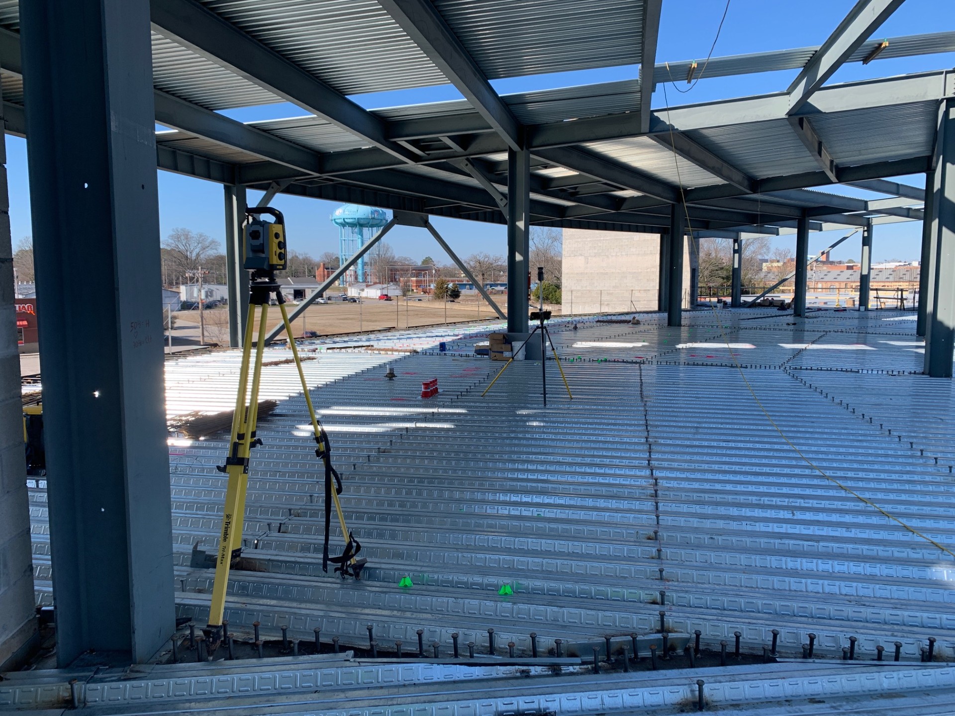
This guide’s focus—turns model readiness into a contractor checklist tied to actual field handoff.—starts with defining the purpose, confirming the governing inputs and coordinate basis, assigning ownership, and releasing only information that is ready for its intended use. The sections below turn that answer into project controls a general contractor, trade partner, fabricator, or project manager can review before the relevant field or coordination work begins.
Clarify the model purpose
A coordination model is not automatically a field layout model. The team must decide which modeled elements should become points, lines, offsets, or elevations for construction.
The practical value appears when the office decision can be recognized at the work face. For BIM data preparation for field layout, that means the model, point, mark, report, or scan must connect to a physical location and a named construction decision. If the connection is unclear, more data will not automatically create certainty. Write the field use next to every requested model element.
Confirm coordinates before export
Shared coordinates, internal origins, and project datums can produce very different results when files move between platforms. A visual match on screen is not enough.
A strong plan also defines the boundary around confirm coordinates before export. CCLS should not be expected to invent missing design intent, approve another party’s work, or infer a tolerance that the project has not supplied. The contractor can protect the schedule by resolving those boundaries before the affected crew depends on the information. Test known coordinates against approved project control.
- Identify the specific decision connected to confirm coordinates before export.
- Confirm the controlling file, field reference, or measured condition for confirm coordinates before export.
- Record the owner, release status, and next robotic total station layout action tied to confirm coordinates before export.
Use buildable reference geometry
Model detail should support the installer’s decision without burying the field file in unnecessary objects. The export should reflect installation references that crews can recognize.
This checkpoint deserves a place in the look-ahead schedule. The input should be available early enough to review, the work area should be physically ready, and the response path should be active if the field condition differs from the released information. On a Southeast United States assignment, those basics are more useful than a broad technology claim. Select centers, faces, offsets, and elevations deliberately.
Screen unresolved coordination issues
Points should not be released from geometry that is still clashing, awaiting approval, or likely to move. A layout-ready status needs a clear release threshold.
Documentation should be proportionate but specific. A dated record tied to screen unresolved coordination issues, the controlling revision, and the affected zone can answer later questions without forcing the team to reconstruct events from email attachments. It should describe what was observed or completed without implying a certification outside the contracted scope. Hold affected zones until the issue owner confirms the geometry.
- Identify the specific decision connected to screen unresolved coordination issues.
- Confirm the controlling file, field reference, or measured condition for screen unresolved coordination issues.
- Record the owner, release status, and next robotic total station layout action tied to screen unresolved coordination issues.

Apply naming that works in the field
Long object identifiers and inconsistent abbreviations slow point selection and increase the chance of choosing the wrong item. Field naming should remain unique and understandable.
The team should test this part of the workflow with a representative example before expanding it across the project. A small proof can reveal coordinate, access, naming, visibility, model-status, or interpretation issues while the correction is still contained. That is especially useful when the released information feeds several downstream trades. Use a short convention for system, floor, zone, and point type.
Check elevations and offsets
A plan location alone may not explain whether a point belongs on the floor, deck, wall, or overhead structure. Offset conventions should be explicit.
When conditions change, update the controlled source and communicate the field impact. Adding a second file or mark without retiring the first creates ambiguity. A disciplined response names what changed, what remains valid, what work is on hold, and who can release the next step. Record the physical surface and direction associated with each offset.
- Identify the specific decision connected to check elevations and offsets.
- Confirm the controlling file, field reference, or measured condition for check elevations and offsets.
- Record the owner, release status, and next robotic total station layout action tied to check elevations and offsets.
Run a small proof before production
A limited set of points can expose coordinate, naming, visibility, or interpretation problems before hundreds of points enter the field workflow.
For Southeast United States, the useful checkpoint is not a generic promise about run a small proof before production. The team should be able to identify the governing input, the person who owns the decision, the release condition, and the field evidence connected to that checkpoint. CCLS can support the digital-to-field portion of the process, while design, survey, engineering, code, and acceptance duties remain with the parties assigned to them. Validate a representative sample with the field team.
Package the release and revision history
The field team needs one current package with its source model, export date, approved revision, and release contact. Older exports should be clearly superseded.
Treat package the release and revision history as a project control rather than an informal conversation. Record the applicable floor or zone, file revision, responsible contact, and downstream activity. That simple discipline helps a robotic total station layout scope remain traceable when schedules or geometry change. It also gives the field team a clear reason to proceed, pause, or request clarification. Issue a controlled package and retain the change history.
- Identify the specific decision connected to package the release and revision history.
- Confirm the controlling file, field reference, or measured condition for package the release and revision history.
- Record the owner, release status, and next robotic total station layout action tied to package the release and revision history.
For clarify the model purpose, a productive review should also compare the planned workflow with a representative real condition. Ask the field team what information is immediately understandable, what requires interpretation, and what would cause them to stop. Then incorporate that feedback into the controlled package before broader release. Write the field use next to every requested model element.
For confirm coordinates before export, a productive review should also compare the planned workflow with a representative real condition. Ask the field team what information is immediately understandable, what requires interpretation, and what would cause them to stop. Then incorporate that feedback into the controlled package before broader release. Test known coordinates against approved project control.
Questions to take into the next project meeting
- What evidence shows that clarify the model purpose is ready for the affected zone?
- What evidence shows that confirm coordinates before export is ready for the affected zone?
- What evidence shows that use buildable reference geometry is ready for the affected zone?
- What evidence shows that screen unresolved coordination issues is ready for the affected zone?
- What evidence shows that apply naming that works in the field is ready for the affected zone?
- What evidence shows that check elevations and offsets is ready for the affected zone?
For Model-to-Field Checklist: Preparing BIM Data for Robotic Layout, a useful next step is to review these questions against the current look-ahead schedule rather than waiting for a field crew to discover a missing decision. The right answer can differ by floor, system, and phase in Southeast United States. What should remain consistent is the chain from approved information to a recognizable field action and a documented response when the actual condition differs.
Teams applying the package the release and revision history guidance can review CCLS’s construction technology services and discuss the specific project scope. For a project-specific conversation, contact CCLS. The consultation can identify the needed inputs, suitable service, and practical next checkpoint without assuming responsibilities that belong to the project’s design or licensed professionals.