
What must the project team decide so the scan captures the surfaces and systems needed for the downstream decision? Translate the intended deliverable into access, line-of-sight, occlusion, and sequence decisions before a scanner arrives. This is a project-control question, not merely a software or equipment question. Conway Coordination and Layout Services, LLC (CCLS) is a family-owned construction technology and field-layout company with more than 20 years of industry experience and verified coverage across South Carolina, North Carolina, Georgia, Florida, and the broader Southeast.
For scanning and point-cloud work, the deliverable must be chosen before capture. Coverage, line of sight, registration, coordinate context, density, modeling scope, and documented gaps determine whether the data can answer the intended renovation, fabrication, verification, or handover question. In “How to Plan 3D Scan Coverage Before Mobilization,” the immediate trigger is concealed geometry is assumed rather than captured. A practical review can follow the specific inputs, decision owners, failure modes, and records described below while preserving the boundaries of design judgment, surveying authority, contract interpretation, and project-specific approval.
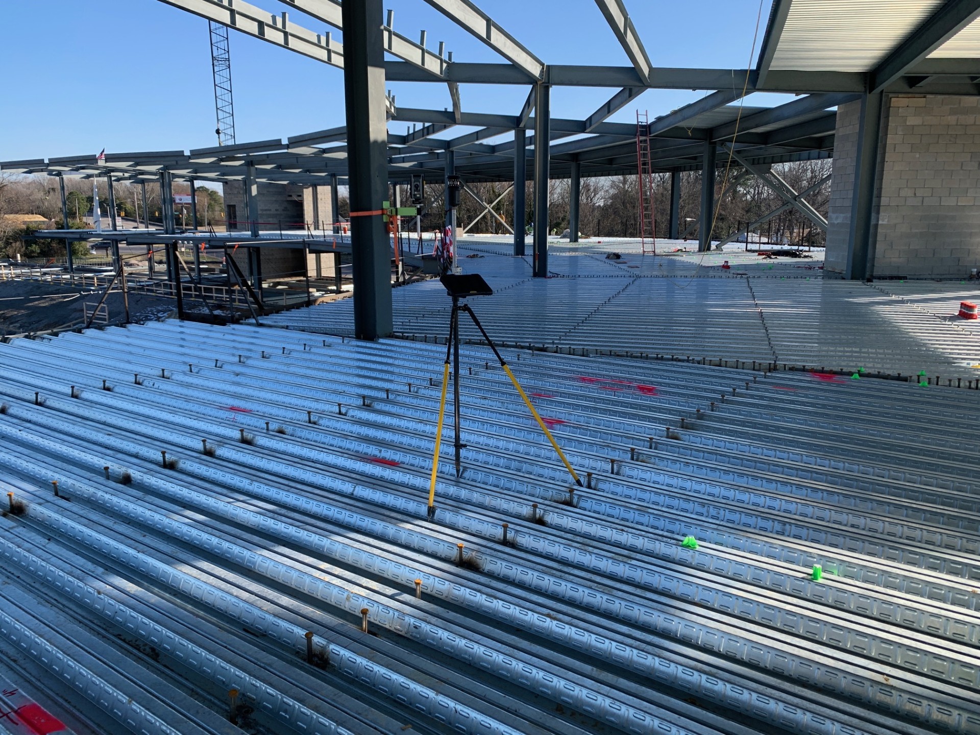
What must the project team decide so the scan captures the surfaces and systems needed for the downstream decision?
Write the question beside the affected element, area, milestone, and downstream user. In this case, the scope must connect “target areas and exclusions” with the decision about “which spaces require full coverage.” If a requested scan, model change, point file, meeting, or field visit does not help make that decision, it should be justified separately instead of quietly expanding this scope.
The boundary is especially important because concealed geometry is assumed rather than captured. CCLS can gather, organize, compare, coordinate, or transfer evidence within the approved service, while the project party holding design, survey, fabrication, installation, or contractual authority makes the governing decision. The final record should show that handoff rather than allowing technical output to imply an approval it does not contain.
Inputs to verify before work starts
For “How to Plan 3D Scan Coverage Before Mobilization,” begin with the smallest complete input set. Every item should have an owner, revision, date, and intended use. If one item is missing, record the gap rather than allowing the team to assume it has been resolved.
- target areas and exclusions. This establishes the revision boundary. Record its owner, status, and supporting evidence before the next decision.
- required downstream deliverable. This clarifies the next coordination step. Record its owner, status, and supporting evidence before the next decision.
- site access windows. This documents the decision trail. Record its owner, status, and supporting evidence before the next decision.
- obstruction and occupancy conditions. This connects the field release. Record its owner, status, and supporting evidence before the next decision.
- control or reference requirements. This protects the responsible party. Record its owner, status, and supporting evidence before the next decision.
Review the inputs as one set. “required downstream deliverable” can change the meaning of “site access windows,” and the effect may not appear until the team reaches “obstruction and occupancy conditions.” The review should therefore record conflicts explicitly, identify the controlling party, and label any missing source instead of filling the gap with an unverified assumption.
Decisions the project team must assign
- which spaces require full coverage. This establishes the revision boundary. Record its owner, status, and supporting evidence before the next decision.
- where occlusion is acceptable. This clarifies the next coordination step. Record its owner, status, and supporting evidence before the next decision.
- whether return visits are practical. This documents the decision trail. Record its owner, status, and supporting evidence before the next decision.
- what must be exposed before capture. This connects the field release. Record its owner, status, and supporting evidence before the next decision.
- how field control ties to the scan. This protects the responsible party. Record its owner, status, and supporting evidence before the next decision.
Assign these decisions before pricing or mobilization. The answer to “where occlusion is acceptable” affects effort differently from “what must be exposed before capture.” Making that distinction lets CCLS connect mobilizations, model preparation, capture extent, coordination meetings, and delivery formats to defined outcomes rather than an open-ended request.

A practical workflow from question to release
- target areas and exclusions. Before anyone releases data, verify this input against the party responsible for which spaces require full coverage. Test the proposed approach where concealed geometry is assumed rather than captured could affect the next activity, then capture the outcome in the coverage plan. Preserve enough context for the next reviewer.
- required downstream deliverable. Next, verify this input against the party responsible for where occlusion is acceptable. Test the proposed approach where access ends before gaps are found could affect the next activity, then capture the outcome in the access and exposure checklist. Keep the result tied to the current revision.
- site access windows. Then, verify this input against the party responsible for whether return visits are practical. Test the proposed approach where temporary materials block critical surfaces could affect the next activity, then capture the outcome in the known-occlusion register. Record who made the decision and why.
- obstruction and occupancy conditions. At the review gate, verify this input against the party responsible for what must be exposed before capture. Test the proposed approach where the capture density exceeds or misses the actual need could affect the next activity, then capture the outcome in the mobilization hold-point list. Separate verified evidence from unresolved assumptions.
- control or reference requirements. Before scale-up, verify this input against the party responsible for how field control ties to the scan. Test the proposed approach where concealed geometry is assumed rather than captured could affect the next activity, then capture the outcome in the coverage plan. Make the release boundary visible to the field team.
The resulting hold points should name the affected element or zone, not freeze unrelated work by default. For this topic, the clearest hold is the one that prevents “access ends before gaps are found” while the team completes the “access and exposure checklist.” That keeps schedule pressure visible without converting an unresolved condition into an informal release.
Failure modes to catch before they reach the field
- concealed geometry is assumed rather than captured. This establishes the revision boundary. Record its owner, status, and supporting evidence before the next decision.
- access ends before gaps are found. This clarifies the next coordination step. Record its owner, status, and supporting evidence before the next decision.
- temporary materials block critical surfaces. This documents the decision trail. Record its owner, status, and supporting evidence before the next decision.
- the capture density exceeds or misses the actual need. This connects the field release. Record its owner, status, and supporting evidence before the next decision.
These failures share one pattern: the project advances because information looks complete even though authority or context is missing. For “How to Plan 3D Scan Coverage Before Mobilization,” the preventive record is the “known-occlusion register.” It should name the source, revision, owner, date, limitation, and next decision so the condition remains visibly open until the right party resolves it.
Deliverables that create a usable record
- coverage plan. This establishes the revision boundary. Record its owner, status, and supporting evidence before the next decision.
- access and exposure checklist. This clarifies the next coordination step. Record its owner, status, and supporting evidence before the next decision.
- known-occlusion register. This documents the decision trail. Record its owner, status, and supporting evidence before the next decision.
- mobilization hold-point list. This connects the field release. Record its owner, status, and supporting evidence before the next decision.
The “coverage plan” and “mobilization hold-point list” serve different readers, so both native and human-readable forms may be useful. Each should distinguish observation from approval, show superseded information, and state whether the contents represent proposed geometry, released layout data, verified existing conditions, or closeout evidence.
Southeast project context and timing
CCLS works across a broad Southeast service area rather than one interchangeable city market. For this article, geography matters only when it changes “site access windows,” “temporary materials block critical surfaces,” access, travel, weather exposure, building type, or project phase. Without that verified connection, the guidance stays regional instead of becoming a city-swapped copy.
For “How to Plan 3D Scan Coverage Before Mobilization,” the useful planning window is the next release or field milestone, not a generic calendar date. Work backward from whether return visits are practical and leave time for input review, exceptions, and an independent check.
Scope-review questions for this decision
What evidence would change the next decision?
Start with “What must the project team decide so the scan captures the surfaces and systems needed for the downstream decision?” and identify the smallest evidence set that could answer it. If “control or reference requirements” is unavailable, the team should decide whether to obtain it, narrow the scope, or keep the affected work on hold. Collecting more data without a decision rule usually creates review work rather than certainty.
Who can accept the remaining exception?
The owner of “how field control ties to the scan” should be named before the exception appears. CCLS can document the condition and provide the agreed technical output, but the project authority must accept, reject, redesign, or otherwise resolve the exception. That boundary should appear in the mobilization hold-point list.
When should the team ask CCLS to help?
For the decision about “which spaces require full coverage,” engage CCLS when the current evidence, milestone, and exception authority are identifiable. That context helps determine whether 3D Scanning, another CCLS service, or a staged combination of verification, coordination, and field execution is appropriate.
Next step
Use “target areas and exclusions,” “which spaces require full coverage,” “concealed geometry is assumed rather than captured,” and “coverage plan” as the first four lines of a project-specific checklist. Mark each line verified, assumed, or waiting on authority. Then contact CCLS for a project consultation with the relevant drawings, model information, schedule, access conditions, and decision deadline. The objective is a traceable project plan without expanding the scope beyond verified facts.