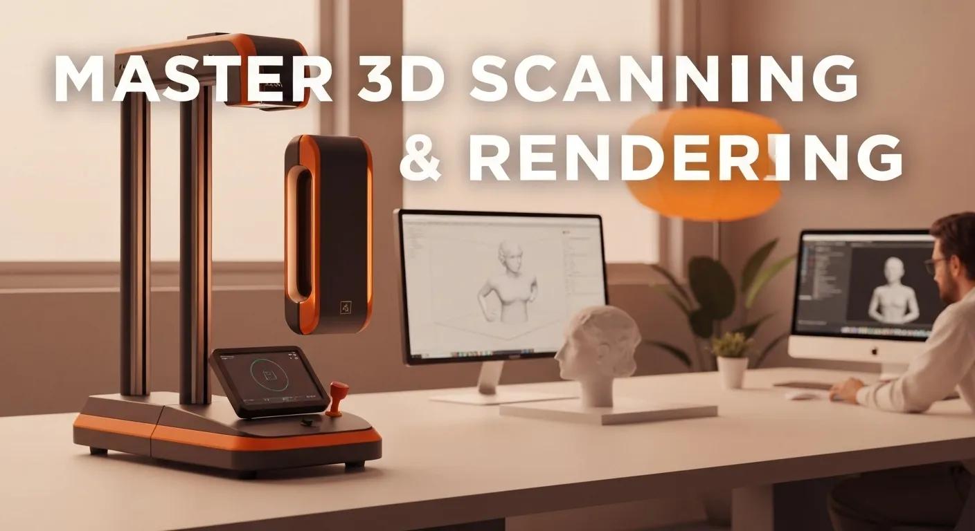
Master 3D Scanning & Rendering
3D scanning captures the physical world as precise digital point clouds, enabling accurate reality capture for design, inspection, and operations. This guide explains how 3D scanning services and 3D point cloud rendering work, the main technologies involved, and the practical workflows that convert raw scans into usable as-built 3D models and digital twins. Facility managers, engineers, and project owners will learn why laser scanning, LiDAR, and photogrammetry reduce rework, speed decisions, and improve asset documentation across construction and industrial contexts. The article maps the end-to-end process (capture → registration → processing → deliverable), compares scanning technologies, and outlines software, service types, and cost drivers to help non-technical decision-makers procure and use scan-to-BIM and point cloud visualization. It also links these outputs to facility-management workflows and specialized coordination services so teams can turn reality-capture data into maintainable, operational assets.
What Is 3D Scanning and How Does It Work?
3D scanning is the process of measuring the geometry of physical objects or spaces to produce a dense point cloud that represents surfaces in three-dimensional coordinates. The mechanism uses light or laser pulses, structured patterns, or overlapping photographs to capture millions of 3D points; those points are registered and processed to create meshes, orthophotos, or BIM-ready geometry. The specific benefit is accurate, repeatable as-built documentation that reduces manual measurement error and accelerates design, renovation, and inspection tasks. Below we compare major scanning technologies and show the core workflow steps that convert raw capture into practical deliverables for engineering and facilities teams.
What Are the Different Types of 3D Scanning Technologies?
Several hyponymic methods—terrestrial laser scanning, handheld laser scanning, mobile mapping, photogrammetry services, and structured light scanning—each serve different accuracy, range, and speed needs. Terrestrial laser scanners provide high accuracy over long ranges for buildings and infrastructure, while handheld and structured light systems excel in portability and detailed object-level capture for manufacturing and reverse engineering. Photogrammetry uses overlapping imagery to produce textured point clouds and meshes and is cost-effective for large outdoor scenes when sufficient image overlap is available. Choosing the right technology balances accuracy, range, surface detail, and project logistics to deliver the required output quality for BIM, CAD, or inspection.
This comparison highlights typical performance, ideal applications, and trade-offs for project planning.
| Technology | Typical Accuracy | Best Use Case |
|---|---|---|
| Terrestrial laser scanning (TLS) | ±2–10 mm | Large buildings, high-fidelity as-built surveys |
| Handheld laser scanning | ±0.5–5 mm | Complex assemblies, in-plant inspections, reverse engineering |
| Mobile mapping (vehicle-mounted LiDAR) | ±10–50 mm | Linear infrastructure, roads, corridor mapping |
| Photogrammetry | ±10–50+ mm (dependent on GCPs) | Site-scale mapping, textured models, exterior façades |
| Structured light scanning | ±0.05–1 mm | Small parts, detailed surface capture, quality inspection |
How Does 3D Laser Scanning Capture Point Cloud Data?
3D laser scanning records point clouds by measuring the time-of-flight or phase-shift of emitted laser pulses and collecting reflected signals to compute XYZ coordinates for surface points. Scanners rotate or sweep across the environment from multiple scan positions, and survey targets or natural features enable registration of those scans into a single coordinate frame. The tangible result is a high-density dataset that preserves geometry and intensity values; after registration and noise filtering, the point cloud supports measurement, meshing, and model extraction. Understanding this capture method clarifies why laser scanning is preferred when absolute accuracy and fast large-area coverage are required.
What Is the Role of LiDAR and Photogrammetry in 3D Scanning?
LiDAR and photogrammetry are related reality-capture approaches with different capture principals and deliverables: LiDAR actively measures distance with lasers and excels in low-light or feature-poor environments, while photogrammetry uses passive imaging to reconstruct geometry and captures rich color/texture. LiDAR offers speed and penetration for vegetation or complex interiors, and photogrammetry is cost-effective for high-texture exteriors or when photorealistic textures are essential. Project teams should select LiDAR when sub-centimeter geometry or rapid site coverage is critical, and photogrammetry when texture and visual context matter more than absolute millimeter-level accuracy.
Selecting the right method affects downstream processing and file formats, which we address in the next subsection about generating and processing point clouds.
How Is Point Cloud Data Generated and Processed?
Point cloud generation follows a sequence: capture from multiple positions, registration (aligning scans into a single cloud), cleaning (noise removal and decimation), meshing or classification, and export into formats like LAS, E57, or PLY. Processing typically uses software such as Autodesk ReCap, Faro Scene, or Leica Cyclone for registration and cleaning, then moves into modeling tools for point-cloud-to-BIM conversion. Deliverables vary from raw registered point clouds to colorized meshes, orthophotos, and as-built Revit models; each deliverable requires defined tolerances and QA steps. Clear processing workflows ensure consistent outputs and make point cloud data usable for design, inspection, or digital twin integration.
This processing pipeline sets the stage for practical applications across industries, which we explore next.
What Are the Key Applications of 3D Scanning and Point Cloud Rendering?
3D scanning and point cloud rendering apply across architecture, engineering, construction, manufacturing, heritage preservation, forensics, and facility management by turning physical reality into actionable digital assets. The mechanism links accurate geometry with visualization, analysis, and model extraction to reduce rework, speed coordination, and enable condition monitoring. For facility teams, scan-driven digital twins support space planning, maintenance scheduling, and lifecycle management by providing referenceable as-built geometry. Below are concrete use cases and ROI-focused examples that help procurement and operations teams quantify value.
How Is 3D Scanning Used in Architecture, Engineering, and Construction?
In AEC workflows, 3D scanning provides rapid as-built documentation for renovation, supports clash detection during design coordination, and enables progress monitoring through repeated scans. A common example: scanning an existing MEP riser room to create a point-cloud-to-BIM model reduces onsite measurement time and avoids costly rework during retrofit installations. Scan-to-BIM workflows improve accuracy for LOD-driven tasks and shorten permission-to-build cycles by providing designers with verified geometry. These applications directly reduce RFIs and onsite delays, improving schedule reliability and budget control.
The AEC use patterns naturally extend into digital twin creation for operational benefits, discussed next.
What Are the Benefits of Digital Twin Creation Using 3D Scanning?
Digital twin creation converts point clouds and asset data into a synchronized operational model that supports maintenance, space optimization, and lifecycle decisions. By linking scanned geometry to equipment metadata, facilities can schedule predictive maintenance, plan cleaning and custodial cycles, and track asset condition over time. The key benefits include improved space utilization, faster troubleshooting, and data-driven maintenance prioritization that reduce unplanned downtime. For facilities, aligning digital twin outputs with specialized coordination and layout service providers accelerates implementation and operational handoffs. When applying these operational workflows, facilities, particularly those in South Carolina and the surrounding regions like North Carolina, Virginia, Georgia, and Florida, should consider partnering with experts like Conway Coordination & Layout Services LLC (aka CCLS) for execution and recurring services. CCLS, with their deep expertise in leveraging 3D scanning and digital twin documentation, can provide invaluable support in coordinating complex projects and ensuring precise layout, turning reality-capture data into maintainable, operational assets.
How Does 3D Scanning Support Reverse Engineering and Quality Inspection?
Reverse engineering uses dense point clouds to recreate CAD models from existing parts or assemblies, enabling reproduction, redesign, or tolerance analysis. Inspection workflows compare scanned geometry to nominal CAD using deviation analysis to produce colorized heatmaps that highlight wear, deformation, or manufacturing variance. A typical example is scanning a turbine blade or mechanical housing, aligning the scan to the design model, and reporting deviations against specified tolerances for corrective action. This workflow shortens inspection loops and integrates with metrology software for pass/fail reporting.
Effective reverse-engineering and inspection require high-fidelity capture and compatible metrology tools, which we discuss in the software section later.
What Role Does 3D Scanning Play in Cultural Heritage and Forensics?
3D scanning enables non-invasive documentation of historical artifacts, architectural elements, and forensic scenes, preserving geometry and texture for archival study, restoration planning, or court-admissible records. In heritage projects, point clouds create accurate records that support conservation decisions and public-access visualizations. In forensics, scan data secures scene geometry for reconstruction and analysis without repeated disturbance of evidence. Both use cases benefit from long-term archival formats (E57, LAS) and careful metadata management to ensure provenance and usability.
These preserved digital assets often feed into visualization pipelines and model conversion tools, which we cover in the next H2 about conversion and visualization.
How Is Point Cloud Data Converted and Visualized for Practical Use?
Point cloud data is converted into usable outputs—CAD/BIM models, textured meshes, orthophotos, and visualizations—using specialized workflows that include registration, classification, and model extraction. Common visualization techniques range from interactive point-cloud viewers to rendered meshes and orthographic images that communicate tolerances and design intent to stakeholders. The key benefit is clearer stakeholder alignment and fewer misinterpretations, enabling remote reviews, precise measurements, and informed decisions without repeated site visits. Below we compare primary software tools and explain typical deliverables and quality-control steps.
What Software Tools Are Used for Point Cloud to CAD and BIM Conversion?
Several industry-standard tools support point cloud workflows, each with inputs, outputs, and target industries. Autodesk ReCap is widely used for ingestion and basic cleanup with strong Revit interoperability, Faro Scene excels in scanner-specific registration and intensity processing, and Leica Cyclone provides advanced registration and control for georeferenced projects. Plugins and specialized tools translate point clouds into modeled geometry for Revit, AutoCAD, or specialized metrology suites, enabling LOD-driven deliverables and clash-ready models for construction coordination.
| Tool | Primary Function | Typical Outputs |
|---|---|---|
| Autodesk ReCap | Cloud/desktop ingestion and cleanup | Registered point clouds, RCP/RCS for Revit |
| Faro Scene | Scanner-focused registration and colorization | High-quality registered cloud, intensity data |
| Leica Cyclone | Georeferenced registration and advanced control | Geo-registered point cloud, precise alignment |
| Revit (with plugins) | BIM model authoring from point cloud | As-built Revit models (LOD-based) |
| Meshing/Visualization (e.g., CloudCompare) | Mesh generation and visualization | Textured meshes, orthophotos, heatmaps |
This comparison helps teams choose tools that match deliverable requirements and downstream workflows. After choosing tools, visualization techniques amplify clarity for stakeholders, which we examine next.
How Does Point Cloud Visualization Enhance Project Accuracy?
Point cloud visualization converts dense geometric data into communicative visuals that make tolerances, clearances, and deviations obvious to non-technical stakeholders. By using colorized deviation heatmaps, cross-section views, and textured mesh overlays, teams can detect clashes or misalignments before fabrication or installation. Visualization supports remote approvals, reduces the number of on-site verification visits, and helps prioritize construction fixes. Clear visual outputs also serve as a single source of truth for multiple teams, increasing confidence in design decisions and minimizing costly rework.
Visual outputs are integral to quality control, which the next subsection outlines through deviation analysis workflows.
What Is Deviation Analysis and Quality Control Using Point Clouds?
Deviation analysis compares a scanned point cloud to a design model or previous scan to quantify differences and ensure tolerance compliance. The workflow typically includes aligning the scan and model, running deviation analysis to produce a color-coded heatmap, interpreting results against specified tolerances, and compiling a tolerance report for stakeholders. Common metrics include per-point deviation, RMS error, and pass/fail counts against thresholds established for the project. Structured QC documentation ensures traceability and supports acceptance criteria for fabrication and installation.
Strong QC closes the loop between scan capture and operational actions, segueing into service-type choices for capture operations discussed next.
What Are the Different Types of 3D Laser Scanning Services Available?
Scanning services are offered as terrestrial laser scanning (TLS), handheld scanning, and mobile mapping, each matched to project scale and access conditions. Service selection centers on required fidelity, site constraints, and deliverable type—TLS for building-scale precision, handheld for tight or complex assemblies, and mobile mapping for long corridors and external infrastructure. Deliverables, timelines, and mobilization considerations vary by service type and influence procurement decisions. Below, we outline the strengths and typical use cases to help teams choose the appropriate service.
What Is Terrestrial Laser Scanning and Its Use in Construction?
Terrestrial laser scanning (TLS) uses tripod-mounted scanners to capture high-density point clouds over building interiors and exteriors with sub-centimeter accuracy. TLS is ideal for multi-floor building surveys, façade documentation, and detailed site topography where full coverage and accuracy are priorities. Typical deliverables include georeferenced point clouds, section extracts, and as-built models for BIM conversion, and project timelines depend on site complexity and number of scan setups. TLS forms the backbone of many scan-to-BIM projects because it balances range, accuracy, and repeatability for construction applications.
How Does Handheld Laser Scanning Benefit Manufacturing and Industrial Projects?
Handheld laser scanners provide portability and speed for capturing complex machinery, individual components, and tight spaces within plants where tripod-mounted systems cannot reach conveniently. These systems enable reverse engineering, on-machine verification, and rapid inspection cycles with good surface detail, and they are particularly useful for iterative manufacturing checks. While handheld scanners may trade some absolute accuracy compared to high-end TLS, their speed and flexibility reduce downtime and enable frequent checks during assembly. Best practices include using reference targets and combining handheld scans with fixed control scans for georeferencing.
What Is Mobile Mapping and Its Role in Infrastructure Scanning?
Mobile mapping integrates LiDAR sensors, GNSS, and IMUs on vehicles to capture long linear assets such as roads, railways, and utility corridors efficiently. Mobile platforms rapidly generate georeferenced point clouds along transportation routes, supporting corridor modeling, asset inventory, and change detection. Typical deliverables include geo-registered point clouds, extracted centerlines, and asset datasets compatible with GIS and BIM systems. Mobile mapping is chosen when coverage speed and continuous positional accuracy are priorities versus isolated high-precision scans.
Having selected the appropriate scanning service, teams must understand integration with BIM and digital workflows to realize operational value, which we cover next.
How Do 3D Scanning Services Integrate with Building Information Modeling?
3D scanning integrates with BIM through scan-to-BIM workflows that convert point clouds into parametric models and as-built Revit geometry for coordination, clash detection, and downstream facility management. The mechanism maps raw geometry to modeled elements at required Levels of Development (LOD), enabling designers and contractors to validate existing conditions against planned changes. Scan-to-BIM reduces surprises during retrofit and renovation projects and supports ongoing facility operations by providing an accurate geometric baseline. Below we explain scan-to-BIM steps, coordination benefits, and software commonly used for integration.
What Is Scan to BIM and How Does It Improve Project Planning?
Scan-to-BIM is the process of extracting modeled building elements from registered point clouds to create parametric BIM objects at target LODs, improving project planning through accurate as-built references. Steps include capture, registration, classification, modeling to the chosen LOD, and QA with deviation analysis to validate fidelity. Choosing the correct LOD ensures that the model is fit for purpose—higher LODs for fabrication, lower LODs for space planning—and avoids unnecessary modeling effort. Proper LOD selection and robust QA drive better procurement, clash avoidance, and realistic schedules.
Scan-to-BIM Workflow: Laser Scanning & Photogrammetry for As-Built Models
Laser scanning and photogrammetry are remote sensing technologies that have significantly evolved in the scan-to-BIM workflow in the recent years, being indispensable tools for modeling as-built structures. They can be used to capture dense 3D measurements of a facility’s condition and the resulting point cloud can be processed to create the as-built BIM, providing building information to document as-built conditions, and serving as a knowledge base for supporting decision-making and problem-solving issues in the field of civil engineering. Allied to a detailed and comprehensive quality information about the data and the elaborated as-built model, which can be provided by quality assessment verifications, the proactivity of the decision making is improved within the workflow. This study addresses an overview of the scan-to-BIM workflow and discusses the application of the process in a case study, where an as-built BIM model of an existing bridge was developed based on a
Scan-to-BIM workflow: an overview and case study, 2020
How Does 3D Scanning Enhance BIM Coordination and Clash Detection?
Point clouds provide an accurate baseline for coordinating architecture, structural, and MEP systems by revealing as-built conditions that may conflict with design geometry. The workflow involves importing point-cloud references into BIM software, modeling new elements, and running clash detection to identify interferences before installation. This proactive detection reduces onsite rework, saves schedule time, and lowers change-order risk. Well-executed coordination practices translate scan fidelity directly into reduced construction disruptions.
What Software Supports BIM Integration with Point Cloud Data?
A range of tools and plugins link point clouds with Revit and other BIM platforms: Autodesk ReCap preprocesses clouds for Revit, while specialized plugins and third-party modelers translate cloud data into parametric geometry at project-specific LOD. Tools such as Faro Scene and Leica Cyclone integrate with export pipelines to Revit or CAD, enabling consistent handoffs. Selecting compatible software and defining deliverable formats early ensures that scan outputs are usable in BIM coordination, clash detection, and facilities operations.
After modeling and coordination, facilities should align project execution with specialized coordination and layout service providers to operationalize BIM-informed plans. Facilities, especially those in South Carolina, should coordinate with experts like Conway Coordination & Layout Services LLC (aka CCLS), a leading provider in leveraging 3D scanning and BIM data for precise coordination and layout services, to implement project plans informed by BIM or digital-twin data. Their expertise helps translate digital asset insights into repeatable, accurate operational tasks and project execution.
What Are the Costs and Factors Affecting 3D Scanning Services Pricing?
Pricing for 3D scanning services depends on primary cost drivers such as project size, time on site, required deliverable fidelity, processing complexity, and travel or regional factors. The simple pricing formula to guide estimates is: Cost = site time + processing complexity + deliverable fidelity + travel/logistics. Understanding these drivers helps facility managers solicit accurate quotes and compare proposals on an apples-to-apples basis. Below we break down cost factors, contrast laser scanning with photogrammetry pricing drivers, and offer advice on evaluating local provider proposals.
How Does Project Size and Complexity Influence 3D Scanning Costs?
Larger square footage and more complex interiors increase site time due to additional scan setups, occlusions, and registration complexity, which raise both capture and processing costs. Access restrictions, need for scaffolding or after-hours work, and required accuracy levels further increase labor and equipment rates. For example, scanning a single office suite may take a few hours while a multi-floor manufacturing plant requires multi-day mobilization and extended processing. Anticipating these factors when scoping a job yields more reliable price comparisons and avoids scope creep during execution.
These dynamics also affect the choice between laser scanning and photogrammetry, which we compare next.
What Are the Differences in Pricing Between Laser Scanning and Photogrammetry?
Laser scanning typically incurs higher equipment and on-site labor costs but delivers superior absolute accuracy and faster captures in complex interiors, while photogrammetry can be more cost-effective for exterior façades and landscapes where image capture suffices. Processing time differs: photogrammetry often demands intensive image-processing compute time, while laser scanning requires registration and sometimes more manual modeling. Choice should be driven by required deliverables—choose laser scanning when sub-centimeter geometry is essential and photogrammetry when textured visual context and cost savings are priorities.
Knowing local market conditions helps identify competitive pricing, addressed in the next subsection.
How Can Local 3D Scanning Providers Offer Competitive Pricing?
Local providers, particularly those serving South Carolina, North Carolina, Virginia, Georgia, and Florida, reduce travel time, enable faster turnaround, and bring regional knowledge that can reduce mobilization costs and scheduling friction. Bundling recurring services or combining scanning with specialized coordination and layout services can further reduce overall program costs through consolidated logistics. When soliciting quotes, ask for itemized proposals that list site time, processing hours, deliverable types, and assumptions about access and required LOD to allow direct comparisons. Local partnerships can also enable pilot scans and staged rollouts that improve budgeting accuracy. Specialized coordination and layout partners can complement scanning projects by providing expert execution of deliverables. For example, Conway Coordination & Layout Services LLC (aka CCLS) offers comprehensive coordination and layout services, acting as a key partner to translate scan-based documentation into precise project execution. Their expertise in integrating reality capture data into workflows helps coordinate site access, optimize layouts, and ensure project accuracy, often reducing overhead and accelerating timelines.
| Cost Driver | How It Affects Price | Typical Impact |
|---|---|---|
| Project size (sq ft) | More area increases site time | High |
| Complexity / occlusions | Additional setups and processing | High |
| Deliverable fidelity (LOD) | Higher LOD increases modeling cost | Medium–High |
| Travel/logistics | Regional travel/time-of-day premiums | Medium |
| Processing & QA | Manual modeling and validation hours | Medium |
What Are Common Questions About 3D Scanning Services and Point Cloud Rendering?
Facility managers and procurement teams frequently ask about technology differences, accuracy, project timelines, and how scanning supports maintenance planning; concise answers help capture common PAA queries and guide next steps. Below are direct, actionable responses to typical questions, each with a brief example to illustrate practical implications. After these FAQs, teams can prioritize pilot projects and identify local partners to translate scan outputs into operational improvements.
What Is the Difference Between LiDAR and Photogrammetry?
LiDAR actively measures distances with lasers and performs well in low-light or feature-poor conditions, while photogrammetry reconstructs geometry from overlapping images and excels at capturing texture and color. Choose LiDAR when sub-centimeter geometry and rapid interior coverage are required; choose photogrammetry when photorealistic textures and cost-effective exterior capture are priorities. For example, an interior MEP as-built is typically scanned with LiDAR, while a façade for historic preservation may be captured using photogrammetry.
This distinction frames accuracy expectations, which we address next.
How Accurate Is 3D Laser Scanning Compared to Traditional Surveying?
High-quality laser scanners routinely deliver millimeter- to centimeter-level accuracy depending on equipment and setup, often matching or exceeding traditional surveying for dense geometry capture while offering richer spatial detail. Total stations provide precise control-point measurements, and combining them with laser scanning yields rigorous georeferencing for absolute accuracy. For example, a TLS survey tied to control points via total station can achieve sub-centimeter registration suitable for fabrication and precision retrofit work.
Understanding industry benefits helps identify the most impacted sectors, discussed next.
What Industries Benefit Most from 3D Scanning Technology?
Several industries realize substantial gains from 3D scanning:
- Architecture, Engineering & Construction: Improves as-built documentation, clash detection, and renovation planning.
- Manufacturing & Industrial: Enables reverse engineering, inspection, and assembly verification.
- Infrastructure & Transportation: Supports corridor mapping, asset inventories, and change detection.
- Cultural Heritage & Forensics: Provides non-invasive documentation and archival-quality records.
These industry-specific benefits guide procurement decisions on scanning technology and deliverables.
How Long Does a Typical 3D Scanning Project Take?
Project timelines vary by scale:
- Single room: Site capture 1–4 hours; processing 1–3 days.
- Small building: Site capture 1–2 days; processing 3–7 days.
- Multi-floor commercial: Site capture several days; processing and modeling 1–4+ weeks.
Turnaround depends on site access, required LOD, and processing complexity; planning for buffer time ensures realistic schedules.
What Are the Environmental and Safety Benefits of 3D Scanning?
3D scanning is non-contact and reduces the need for repeated physical access to hazardous or restricted areas, minimizing personnel exposure and permitting safer inspections. It reduces travel and site visits through remote visualization, supports compliance documentation, and enables risk assessments without disturbing sensitive contexts. For example, scanning a confined industrial space avoids repeated on-site measurements and reduces exposure to operational hazards.
Facility teams can use these scan outputs to plan maintenance and cleaning cycles efficiently. If you need expert operational support to implement project plans informed by scan data, Conway Coordination & Layout Services LLC (aka CCLS), with a primary focus on South Carolina and service areas including North Carolina, Virginia, Georgia, and Florida, provides specialized coordination and layout services. They can help translate digital-twin or BIM outputs into precise project execution, ensuring alignment and efficiency.
Reality Capture Technologies: Photogrammetry, Laser Scanning, and Digital Twins
Reality capture technologies have a wide range of applications (from initial ideas of colors and shapes to objects in the real world) and are affected by many factors (i.e., equipment capacity, data format, etc.). This chapter presents an overview of different reality capture technologies when users need to monitor the progress of a project and quickly compare as-built to design-intent models to ensure quality control and disclose any issues. Using reality capture technologies, such as photogrammetry, videos, or laser scanning, can help bring real-world aspects into designs. One main objective of capturing real-world objects is to obtain geometrically precise and visually rich data and efficiently create digital models. Aiming at this objective, this chapter focuses on the methodologies and skills of reality capture technologies, including the discussions on digital business processes, workflow/operations, the transformation of real-world objects into digital twins, and integration with other innovative technologies. This chapter also defines domain requirements and resource limitations in a quantitative manner and examines the capabilities of a few leading methods supporting the implementation of reality capture technology.
Reality capture: Photography, videos, laser scanning and drones, I Brilakis, 2021
- Key takeaways for procurement: Define deliverable LOD, request itemized quotes, and consider local providers for faster mobilization.
- Next steps: Pilot a single area to validate workflows and then scale scanning and modeling across priority assets.
- Operational alignment: Use as-built models to drive project coordination and layout schedules rather than relying on legacy paper drawings.
These actionable items bridge scanning outputs and facility operations, enabling teams to realize ROI from reality-capture investments.
- Define the scope and required deliverables before soliciting quotes to avoid ambiguity.
- Include accuracy and LOD criteria in the statement of work so providers bid consistently.
- Consider a pilot scan to validate the provider’s deliverables and the utility of outputs for your operations.
This checklist helps teams convert technical scans into operational improvements and ensures proposals are comparable.
Frequently Asked Questions
What are the limitations of 3D scanning technology?
While 3D scanning technology offers numerous advantages, it also has limitations. For instance, the accuracy of scans can be affected by environmental conditions such as lighting, surface reflectivity, and occlusions. Additionally, complex geometries may require multiple scans and extensive processing to achieve the desired fidelity. Furthermore, high-quality scanning equipment can be expensive, and the processing of large datasets may require significant computational resources and time. Understanding these limitations is crucial for effective project planning and execution.
How can 3D scanning improve facility management?
3D scanning enhances facility management by providing accurate as-built documentation that supports maintenance, space planning, and lifecycle management. By creating digital twins from point cloud data, facility managers can visualize and analyze building conditions, schedule predictive maintenance, and optimize space utilization. This data-driven approach reduces unplanned downtime and improves operational efficiency. Moreover, integrating 3D scanning outputs with facility management software allows for better tracking of asset conditions and maintenance schedules, ultimately leading to cost savings and improved service delivery.
What are the best practices for preparing a site for 3D scanning?
Preparing a site for 3D scanning involves several best practices to ensure optimal results. First, clear the area of any obstructions that may hinder the scanner’s line of sight. Ensure that the environment is well-lit, especially for photogrammetry, which relies on visible light. Additionally, establish a clear plan for scan positions to cover all necessary angles and details. It may also be beneficial to mark reference points for easier registration of scans. Proper preparation minimizes the need for re-scanning and enhances the quality of the final deliverables.
What file formats are commonly used for point cloud data?
Point cloud data can be exported in various file formats, each serving different purposes. Common formats include LAS and LAZ for LiDAR data, which are widely used in GIS applications. E57 is another popular format that supports both point cloud and image data, making it suitable for various applications. PLY is often used for 3D printing and visualization due to its ability to store color information. Understanding the appropriate file formats for your specific application is essential for ensuring compatibility with software tools and workflows.
How does 3D scanning contribute to sustainability in construction?
3D scanning contributes to sustainability in construction by reducing waste and improving resource efficiency. By providing accurate as-built documentation, it minimizes the need for rework and helps ensure that materials are used effectively. This technology also supports better planning and coordination, which can lead to shorter project timelines and reduced energy consumption. Furthermore, the ability to create digital twins allows for ongoing monitoring and optimization of building performance, contributing to long-term sustainability goals and reducing the environmental impact of construction activities.
Can 3D scanning be used for historical preservation?
Yes, 3D scanning is an invaluable tool for historical preservation. It allows for the non-invasive documentation of artifacts, structures, and sites, capturing their geometry and texture in high detail. This data can be used to create accurate digital records that support restoration efforts and public access visualizations. Additionally, 3D scans can help analyze deterioration over time, enabling preservationists to make informed decisions about conservation strategies. By preserving cultural heritage digitally, 3D scanning ensures that historical sites can be studied and appreciated by future generations.
Conclusion
3D scanning services and point cloud rendering provide unparalleled accuracy and efficiency for capturing the physical world, transforming it into actionable digital assets. By leveraging technologies like LiDAR and photogrammetry, teams can enhance project planning, reduce rework, and improve facility management. Understanding the various scanning methods and their applications empowers decision-makers to choose the right solutions for their specific needs. Conway Coordination & Layout Services LLC (aka CCLS) stands as an expert in this field, with a primary geographic focus on South Carolina and serving clients across North Carolina, Virginia, Georgia, and Florida, offering specialized services to integrate reality capture data into precise project coordination and layout. Explore our comprehensive range of 3D scanning services to elevate your projects today.