Precision in Every Detail: As-Built Verification Services

Ensure your construction projects are precise with our as-built verification services. We provide expert coordination for flawless execution and peace of mind.
Elevate Projects with Professional VDC Consulting Services
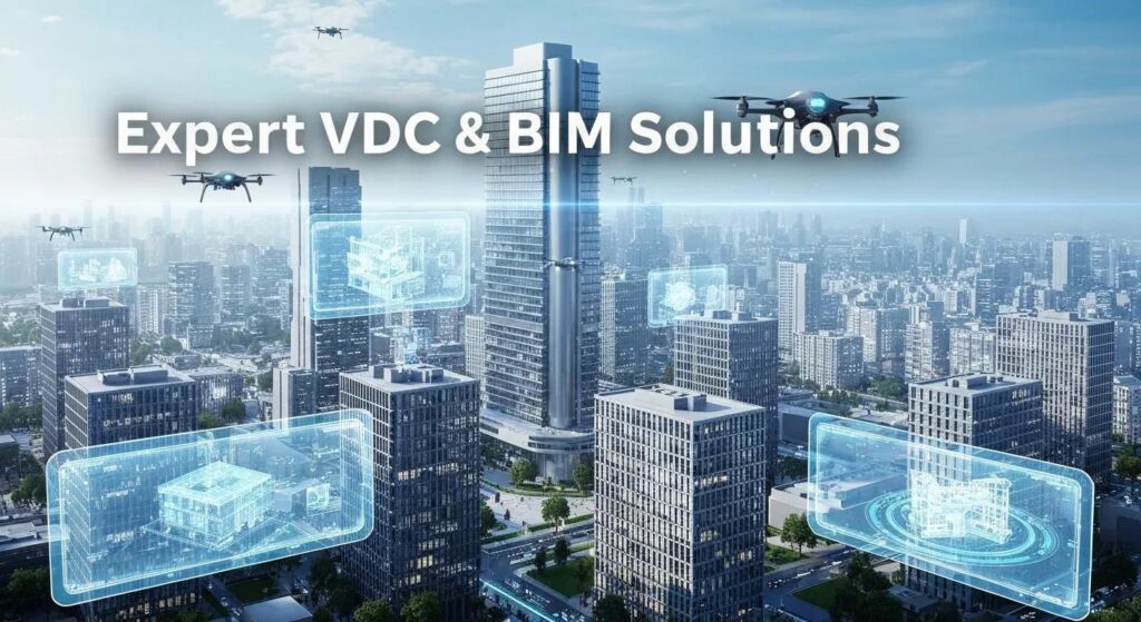
Elevate project outcomes with expert VDC consulting services. Enhance collaboration and efficiency through expert BIM coordination tailored to your needs.
Enhance Precision with Expert 3D Scanning Services
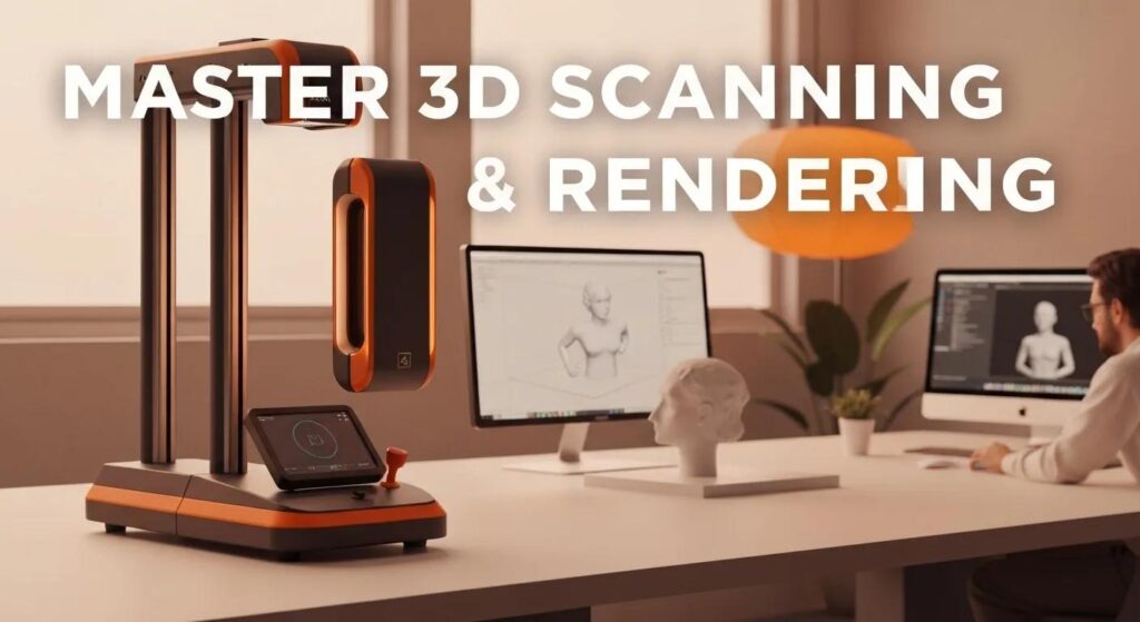
Unlock accurate results with expert 3D scanning services. Transform projects using precise 3D point cloud rendering for enhanced efficiency and detail.
Reliable BIM Modeling Services for Your Project Success

Elevate project success with reliable BIM modeling services. Our expert team provides effective BIM and VDC solutions tailored to your unique needs.
Discover the Benefits of Robotic Total Station Layouts Today
Robotic total station layouts transform construction efficiency and precision. Learn how BIM coordination services enhance project outcomes in South Carolina.
construction technology services,precise construction layout
Construction Technology Services and Precise Construction Layout Solutions for Accurate Project Execution Precise construction layout and construction technology services combine advanced surveying hardware, reality-capture workflows, and model-driven coordination to deliver millimeter-level accuracy on modern builds. This article explains what construction technology services include—from Robotic Total Station layout to BIM coordination, VDC consulting, and 3D laser scanning—and why those services materially reduce errors, rework, and schedule risk. Readers will learn how each technique works, the measurable outcomes to expect, and practical applications across commercial, industrial, healthcare, manufacturing, and preservation projects. The guide maps technical workflows (setup, referencing, stakeout, verification), digital integration points (scan-to-BIM, clash detection, fabrication-ready models), and quality controls that ensure layout aligns to design intent. Sections cover what these services are and why they matter, how Robotic Total Stations produce millimeter precision, the role of BIM coordination in preventing clashes, VDC benefits for sequencing, 3D scanning uses for as-built documentation, industry-specific examples, and the certifications and expertise that guarantee reliable delivery. What Are Construction Technology Services and Their Role in Precise Construction Layout? Construction technology services are integrated digital-construction offerings that combine surveying hardware, reality capture, and model-based coordination to translate design models into accurate, verifiable field layout. They work by converting design coordinates into field stake points and verification deliverables using tools such as Robotic Total Stations, 3D laser scanners, and BIM/VDC platforms, producing outcomes that reduce layout errors and improve predictability. The primary role of these services is to minimize human transcription, enable fabrication-ready deliverables, and provide objective verification (reports and as-built models) that support inspections and handover. Understanding this role helps project teams select the right blend of tools—automated stakeout for new construction, scan-to-BIM for renovations, and model coordination for complex MEP-heavy projects. Construction technology services deliver three consistent benefits: Reduced errors and rework through model-driven stakeout and verification. Faster delivery and schedule confidence by resolving clashes before field installation. Cost control from fewer RFIs and fabrication adjustments. These components together create a feedback loop between field measurement and the digital model, improving control over layout quality and enabling tighter tolerances on critical elements. Inform potential clients about services, establish credibility, and generate leads for projects. How Do Robotic Total Station Services Enhance Construction Accuracy? Robotic Total Station (RTS) services automate the stakeout and verification process by combining precise angle and distance measurement with remote or single-operator control, producing coordinate-accurate layout points directly from design models. RTS eliminates much of the manual measurement chain—reducing transcription errors—and enables rapid iterative verification of installed elements against model coordinates. Typical outcomes include anchor bolt placement to within millimeter tolerances, accurate MEP supports and racks, and consistent grid or column positioning for structural elements. The impact on project quality is immediate: fewer punch items, reduced shop rework, and faster acceptance cycles when verification reports accompany deliverables. This capability directly supports downstream prefabrication and fabrication-ready modeling by providing trustworthy field references for shop drawings. What Is BIM Coordination in Construction and Why Is It Essential? BIM coordination is the process of consolidating trade models into a single coordinated model, performing clash detection and resolution, and producing deliverables that inform accurate field layout. It operates by importing discipline models (architectural, structural, MEP) into coordination software, running automated clash checks, and driving coordination meetings that resolve conflicts before fabrication or installation. The essential benefit is that coordination shifts costly discovery from the field to the model environment, enabling fabrication-ready outputs and reducing on-site rework. Accurate coordinated models also provide the precise coordinate references used by survey and layout teams for stakeout and verification, linking virtual model intent to physical placement on-site. Effective BIM coordination therefore underpins accurate construction layout and supports schedule adherence by reducing late changes. How Do VDC Services Improve Construction Planning and Execution? Virtual Design and Construction (VDC) services extend BIM coordination into simulation, sequencing, and digital construction planning to optimize how work is executed on-site. VDC activities—4D simulations, logistics planning, and digital-twin scenarios—help identify sequencing conflicts and spatial constraints that could compromise layout or create installation delays. By simulating erection and MEP installs before they occur, VDC reduces the likelihood of trades encountering inaccessible or misaligned elements during layout. Contractors benefit from clearer schedules, coordinated deliverable handoffs, and reduced site downtime because model-driven sequencing anticipates clashes and access issues. These gains translate into more efficient stakeout windows, less rework during high-cost trades, and improved productivity across the construction lifecycle. What Are the Advantages of 3D Laser Scanning in Construction Surveying? 3D laser scanning, or reality capture, records existing site conditions rapidly and at high resolution, producing dense point clouds that form the basis for accurate as-built documentation and scan-to-BIM modeling. Scans capture geometry, embedded items, and as-built conditions that are difficult or time-consuming to record manually, making scanning ideal for renovations, verification, and QA/QC tasks. The point-cloud outputs enable direct comparison to design models to detect deviations, support clash detection against existing conditions, and generate precise base models for retrofit work. Because scanning reduces the time on-site and delivers verifiable digital records, it shortens decision loops and decreases the uncertainty that often drives contingency budgets and schedule buffers. Why Is Precise Construction Surveying Critical for Project Success? Precise construction surveying ensures that built elements align to design tolerance, reducing the risk of cascading errors that cause schedule delays and costly rework. Mislocated anchor bolts, incorrectly placed MEP supports, or shifted grid lines can force shop rework, create fabrication rejects, and trigger demolition or repair—outcomes that consume time and budget. Precise surveying supports compliance and inspection by producing traceable verification deliverables, which expedite acceptance and handover. Investing in accurate layout and verification is therefore an insurance mechanism that protects schedule, quality, and cost outcomes while enabling predictable prefabrication and faster occupancy. How Does Robotic Total Station Layout Deliver Millimeter-Level Precision? Robotic Total Station workflows deliver millimeter-level precision by integrating high-accuracy electronic distance measurement, prism-based angle control, and digital coordinate transfer from BIM models into field controllers. A typical process includes instrument setup, control point referencing, automated stakeout of coordinates,
digital construction coordination,building layout specialists
Digital Construction Coordination and Building Layout Specialists: Precision Solutions for Efficient Project Execution Digital construction coordination brings model-driven accuracy and field-ready layout together to reduce errors, prevent rework, and keep schedules on track for complex commercial and industrial projects. This article explains how coordinated workflows — combining BIM, VDC, robotic total stations, and 3D laser scanning — translate digital geometry into reliable field stakeout and fabrication-ready deliverables. Readers will learn the core technologies, practical processes for MEP and structural layout, and how these services improve installation accuracy and sequencing. The content also maps common decision metrics (accuracy tolerance, clash counts, schedule days saved) and shows how to evaluate providers on technical fit and regional delivery. Finally, the guide previews service-specific workflows for Robotic Total Station layout, VDC construction services, BIM coordination, and 3D scanning, then explains how a specialist provider such as CCLS LLC can integrate these capabilities into daily project execution to inform, establish credibility, and generate leads for construction projects. What Is Digital Construction Coordination and Why Is It Essential? Digital construction coordination is the process of aligning design models, reality-capture data, and field layout so that what is built matches the intended design with minimal rework. It works by using coordinated BIM models, clash detection tools, and reality-capture reference geometry to drive precise field stakeout and prefabrication. The specific benefit is fewer on-site conflicts, measurable reductions in RFIs and rework, and improved confidence in schedule milestones. Understanding these mechanisms helps project teams move from reactive fixes to preemptive resolution, which lowers cost uncertainty and protects critical-path activities. How digital coordination improves outcomes can be expressed succinctly in measurable benefits: Reduced rework: Model-driven clash detection prevents conflicting installations before field work begins. Better schedule adherence: 4D sequencing identifies sequence conflicts and optimizes installation order. Higher layout accuracy: Model-to-field transfer via robotic total stations and scan-verified coordinates minimizes positional errors. Fabrication readiness: Coordinated models enable prefabrication with fewer tolerance issues. These benefits depend on integrating design and field workflows through common data and verification steps, which leads directly into how coordination improves project accuracy. How Does Digital Construction Coordination Improve Project Accuracy? Digital coordination improves project accuracy by converting design geometry into verifiable, field-consumable coordinates and then validating installations against that digital baseline. Clash detection flags geometric conflicts between trades before procurement or site work, while model-based measurement provides exact reference points for stakeout teams. By using reality capture (point clouds) to confirm existing conditions and by exporting coordinated model coordinates for field instruments, teams reduce subjective layout interpretation and the common error sources of manual measurement. Tracking KPIs such as open clash counts, stakeout verification passes, and as-built variance helps quantify improvements and close the feedback loop to designers. Clear verification routines and acceptance tolerances create predictable handoffs between office and field, which supports more reliable installations and fewer costly callbacks. What Are the Key Technologies Behind Digital Construction Coordination? Several core technologies form the backbone of modern digital coordination: Building Information Modeling (BIM) as the single source of truth, Virtual Design and Construction (VDC) for sequencing and simulation, robotic total stations for model-driven stakeout, and 3D laser scanning to capture accurate as-built conditions. Each technology plays a distinct role: BIM stores geometry and metadata, VDC models time and process, robotic total stations transfer coordinates to the field, and point clouds verify installed conditions. Together these tools enable a seamless pipeline from design to fabrication and field verification, and understanding their roles clarifies how to structure coordination workflows for measurable outcomes. BIM models: 3D geometry plus metadata used for coordination and layout. Robotic total stations: Field instruments that stake coordinates with sub-centimeter precision. 3D laser scanning: Reality capture that produces point clouds for as-built verification. VDC/4D workflows: Time-linked simulations that reduce sequencing clashes and optimize logistics. These elements combine into repeatable processes that convert design intent into validated construction results. How Does Robotic Total Station Layout Enhance Construction Layout Accuracy? Robotic total station (RTS) layout enhances construction accuracy by directly transferring model coordinates into the field with high repeatability and minimal human interpretation. The mechanism is straightforward: coordinated model points are exported to stakeout files, control points are established on-site, and the RTS guides operators to place or verify elements to within the instrument’s tolerance. The result is fewer positional errors for MEP routing, structural embeds, and anchor bolt locations, which reduces rework and supports prefabrication alignment. Understanding this model-to-field workflow clarifies why robotic layout is standard for projects requiring precise tolerances and repeatable verification. Before the technical details, consider a quick comparison of RTS vs conventional methods to highlight impacts and error sources. Layout Approach Typical Accuracy Common Error Sources Robotic Total Station Sub-centimeter to centimeter Control point setup, instrument calibration Conventional Tape & Transit Several centimeters to decimeters Human measurement error, cumulative offsets Laser Level/Manual GPS 1–5 cm (site-dependent) Line-of-sight obstructions, calibration drift This comparison shows how RTS reduces cumulative error by relying on digital coordinates and instrument automation rather than manual transference. The next section explains the RTS workflow step-by-step. What Is Robotic Total Station Layout and How Does It Work? A robotic total station is an automated surveying instrument that measures angles and distances and can be controlled remotely to locate specific coordinates from a digital model. The workflow begins with exporting stakeout points from a coordinated BIM model into instrument-compatible formats, establishing on-site control points tied to survey datum, and using the RTS to guide the prism or reflector to each model coordinate for physical marking. Verification steps include re-measuring installed anchors or embed locations and comparing measured positions to model coordinates, creating a rapid feedback loop for quality control. This process eliminates layered manual measurements and replaces them with a direct model-driven stakeout that preserves design intent. The RTS workflow supports a direct handoff between modeling and field execution, which leads naturally to the device-specific benefits of instruments such as Trimble systems. What Are the Benefits of Using Trimble Robotic Total Station in Building Layout? Using Trimble robotic total stations in
point cloud rendering services for contractors,as-built verification in commercial construction
Point Cloud Rendering Services and As-Built Verification for Contractors in Commercial Construction Point cloud rendering and as-built verification combine reality-capture methods with model-based analysis to give contractors precise, actionable insight into existing conditions and installation quality. This article explains how 3D point cloud rendering and as-built laser scanning reduce rework, shorten schedules, and strengthen coordination across trades by translating raw LiDAR and scan data into BIM-ready deliverables and verification reports. Readers will learn what point cloud rendering is, how scan-to-BIM workflows integrate into VDC, where verification produces measurable ROI, and how contractors can procure and implement these services on commercial projects. Practical sections cover technologies and software, LOD guidance for deliverables, industry-specific use cases for industrial, pharmaceutical, and healthcare projects, and the latest trends such as AI-assisted processing and digital twins. Throughout, semantic connections highlight mechanisms—capture → processing → comparison → remediation—so construction teams can adopt point cloud workflows that align with existing BIM/VDC systems and risk-mitigation strategies. What Are Point Cloud Rendering Services and How Do They Benefit Contractors? Point cloud rendering services transform raw 3D scan data into visualized, navigable representations and model-ready outputs that contractors use for dimensional verification, coordination, and installation planning. The mechanism combines high-density LiDAR or terrestrial laser scanning with registration, noise filtering, and visualization tools so stakeholders can inspect existing conditions at millimeter-level tolerances and detect clashes or deviations before field labor begins. Primary contractor benefits include reduced rework through early clash detection, clearer preconstruction visualization for trades, faster prefabrication decisions, and objective baseline documentation for QA/QC. These services produce deliverables such as registered point clouds, meshed models, orthographic overlays, and BIM-ready geometry that integrate directly into VDC workflows for downstream coordination. Point cloud rendering yields several practical advantages for construction teams: Faster clash detection and fewer RFIs by visualizing MEP/structural interfaces early. Reduced rework and change orders through dimensional verification against design intent. Improved prefabrication accuracy by supplying precise shop-geometry and layout data. These benefits translate into measurable schedule and cost reductions on complex commercial jobs, and the next subsection outlines the capture-to-model workflow contractors should expect. What is point cloud modeling and 3D reality capture? Point cloud modeling begins with field capture—terrestrial laser scanning, mobile LiDAR, or photogrammetry—followed by registration to unify scans into a single coordinate system and cleaning to remove noise and outliers. Processing continues with segmentation and classification so distinct building systems (structural, architectural, MEP) can be extracted and prepared for visualization or modeling, then exported as registered point clouds, meshes, or BIM-referenced geometry. Typical datasets vary by project size and density requirements; for commercial interiors, capture densities are planned to meet millimeter-level tolerance targets and ensure model fidelity for fabrication. Understanding these steps clarifies why careful planning of control points and capture density directly affects model usability and downstream coordination. How does point cloud rendering improve construction accuracy and reduce errors? Point cloud rendering improves accuracy by providing a measured, auditable reference of existing conditions that can be compared directly to design models for tolerance checks and clash identification. Automated clash detection and tolerance analysis flag physical interferences or dimensional deviations before installation, which prevents trade conflicts and reduces field rework costs. Contractors can use rendered overlays and section extractions from the point cloud to communicate precise cut/fix instructions and prefabrication dimensions, improving off-site fabrication accuracy. These verification-driven workflows shorten schedules by reducing on-site iterations and enable earlier, confident procurement of long-lead prefabricated components. What technologies are used in point cloud rendering for commercial construction? Modern point cloud rendering relies on a blend of hardware—terrestrial laser scanners, mobile LiDAR units, and robotic total stations—and software for registration, cleaning, modeling, and visualization such as point-cloud processors and BIM platforms. Trimble Robotic Total Station systems often provide survey-grade control and millimeter-level layout capability for tying scans into site coordinates, while LiDAR sensors and terrestrial scanners deliver dense surface geometry for interiors and exteriors. Software tools import, register, and convert point clouds into meshes or BIM objects for use in Revit, Navisworks, and VDC platforms; these tools also support orthographic extraction and tolerance reporting. Integrating these technologies into a coherent workflow ensures accurate deliverables for coordination and verification across trades. Deliverable Type Output Format Typical Use Case and Accuracy Registered Point Cloud E57 / LAS / PTS As-built reference for measurements; sub-centimeter to millimeter-level when properly controlled Mesh / Triangulated Model OBJ / PLY Visualization and clash visualization; useful for existing-surface representation BIM-ready Geometry Revit families / IFC Coordination, fabrication, and scheduling; modeled to agreed LOD for trades Orthographic Overlays PDF / Image Field layout and verification by installers; quick visual comparisons This comparison clarifies which outputs contractors select based on accuracy needs and downstream workflows. How Does As-Built Verification Ensure Construction Quality and Prevent Rework? As-built verification compares measured conditions captured by laser scanning against design intent to identify deviations, confirm installations, and document compliance with tolerances and contract requirements. The verification mechanism uses registered point clouds and automated deviation analysis to produce color-mapped overlays, deviation reports, and actionable punch lists that direct remediation before issues propagate into costly rework. Key outcomes include earlier detection of misaligned penetrations or incorrectly routed MEP systems, validated anchor and embed locations, and documented handover records that reduce disputes. Below is a concise process summary followed by evidence of typical ROI attributes contractors can expect from verification workflows. The verification workflow follows these steps: Field capture of as-built conditions to project control. Model-to-point-cloud comparison with tolerance thresholds. Generation of annotated verification reports and remediation plans. These steps close the loop between capture and construction, enabling data-driven decisions that limit defects and schedule slippage. What is as-built laser scanning and how is it applied in commercial projects? As-built laser scanning captures precise geometries of installed elements—MEP runs, ductwork, structural members, and anchors—producing a reliable digital record for verification, commissioning, and owner handover. In commercial sites, scanning is applied after key milestones (rough-ins, pre-finishes, final installation) to validate clearances, confirm penetrations, and verify fabricated assemblies before installation. Recommended capture density and control depend on
construction layout services South Carolina, how to improve construction layout accuracy
Precision Construction Layout Services in South Carolina: How to Improve Construction Layout Accuracy Construction layout services establish the precise reference points and control necessary to translate design intent into built reality, and they directly determine whether structures, MEP systems, and anchors are located within specified tolerances. Many projects lose time and budget because layout errors propagate into rework, delayed installs, and disputed tolerances; this guide shows practical, model-driven and instrument-level steps contractors and survey teams can use to reduce those risks. Inform potential clients about services, establish credibility, and generate leads for projects. The article maps core concepts—what construction layout services cover, how robotic total stations (RTS) and VDC/BIM workflows raise accuracy, where 3D scanning and reality capture fit, and a compact set of best practices and buyer questions for South Carolina projects. Throughout, the focus is on actionable methods—control network design, model-to-field data exchange, verification workflows, and simple checklists—so teams can measure and verify layout accuracy on-site and reduce rework. What Are Construction Layout Services and Why Are They Critical in South Carolina? Construction layout services define, stake, and verify the exact positions of structural elements, MEP systems, foundations, and anchors so installations meet design tolerances and regulatory requirements. These services work by transferring control points from design models or survey control into the field using precision instruments and verified coordinate systems, producing deliverables such as control plans, stake marks, anchor bolt locations, and as-built records. Accurate layout reduces costly rework, shortens schedules, and improves safety and quality, particularly for complex commercial and industrial projects common in South Carolina’s expanding construction market. Understanding the specific tasks and outcomes of precision surveying helps owners and contractors set measurable acceptance criteria and reduce project risk. What Does Precision Construction Surveying Involve? Precision construction surveying involves establishing a project control network, performing layout transfer, and producing verification deliverables that confirm positional tolerances have been met. The process begins with control point establishment tied to a coordinate system, followed by layout transfer to mark footings, anchors, columns, and MEP risers using instruments like robotic total stations and GNSS where appropriate. Deliverables typically include control point logs, layout staking maps, anchor-bolt verification reports, and as-built point clouds or CAD exports for the record. Field workflows emphasize cross-checks and documentation so that each layout milestone can be rechecked and signed off before subsequent trades proceed. How Does Accurate Layout Impact Project Costs and Timelines? Accurate layout reduces downstream change orders and trades’ downtime by preventing mislocated embeds, misaligned structure, and clashes that require demolition or rework, which often drive schedule slippage and cost escalation. When layout tolerances are met at each milestone, installation proceeds smoothly, inspectors approve work faster, and shop-fabricated components fit as intended, shortening lead times. Quantifying savings begins by tracking rework hours and change-order costs per incident and comparing them to the cost of precision layout services; many projects find layout accuracy reduces contingency draw and speeds commissioning. Setting tolerance acceptance criteria upfront converts layout precision into measurable schedule and budget benefits. Which Industries Benefit Most from Construction Layout Services in South Carolina? Several industries derive outsized value from tight layout control because they require high positional accuracy and coordinated installations that leave little margin for error. Commercial builders, healthcare facilities, and industrial plants depend on precise anchor bolt locations and MEP routing to avoid costly field corrections during fit-out and equipment installation. Public works and government projects demand documented compliance and traceable as-built records, while renovation and retrofit work benefit from precise as-built captures to coordinate new work with existing conditions. Prioritizing layout accuracy in these sectors reduces risk, preserves schedule, and protects capital investments. How Does Robotic Total Station Technology Improve Construction Layout Accuracy? A Robotic Total Station (RTS) is a precision surveying instrument that measures angles and distances and communicates directly with field crews and digital models, enabling millimeter-level layout transfer and single-operator workflows. RTS devices lock onto reflectors or targets and, when paired with model coordinates or layout files, can deliver field points with high repeatability while reducing crew size and human transcription errors. This instrumentation integrates with BIM and VDC workflows so model coordinates become field-ready points that installers and surveyors use to verify installation accuracy. The result is faster layout cycles, fewer clashes in the field, and lower rework rates compared with many traditional approaches. Introductory comparison table showing how RTS workflows differ from conventional methods follows; the table highlights accuracy, labor, time, and error-reduction characteristics for procurement and planning discussions. Approach Typical Accuracy Typical Crew Size Primary Benefit Robotic Total Station Layout Millimeter-level (when calibrated) 1–2 persons High repeatability, model integration, fast verification Traditional Optical/Manual Staking Centimeter-level 2–3 persons Lower equipment cost, higher labor needs GNSS-Based Layout (open sites) Centimeter- to decimeter-level 1–2 persons Good for site control, limited indoor utility What Is a Robotic Total Station and How Does It Work? A Robotic Total Station combines an EDM (electronic distance meter), angle encoder, onboard computing, and remote operation to measure coordinates relative to established control points and to execute layout files derived from models. The instrument locates a reflector or active target placed by field technicians or attached to a rover, measures distance and angle, and computes 3D coordinates that are matched to model points or layout lists. Integration with software allows a technician to call points from a tablet or field controller and see measured versus design coordinates, enabling immediate verification and adjustment when tolerances are exceeded. This model→RTS→field workflow reduces handoffs and transcription errors. What Are the Benefits of Using Robotic Total Station Layout for MEP and Structural Projects? RTS layout yields specific operational benefits for MEP and structural work by delivering tight positional control for anchor bolts, hanger locations, embedded items, and structural column centers that are critical to fit and finish. Millimeter-level precision reduces delays caused when prefabricated elements don’t align with field conditions, improving installation speed and reducing change orders. For MEP systems, precise hanger and riser locations prevent clashes and streamline fabrication of supports and racks. The